|
|
|
| |

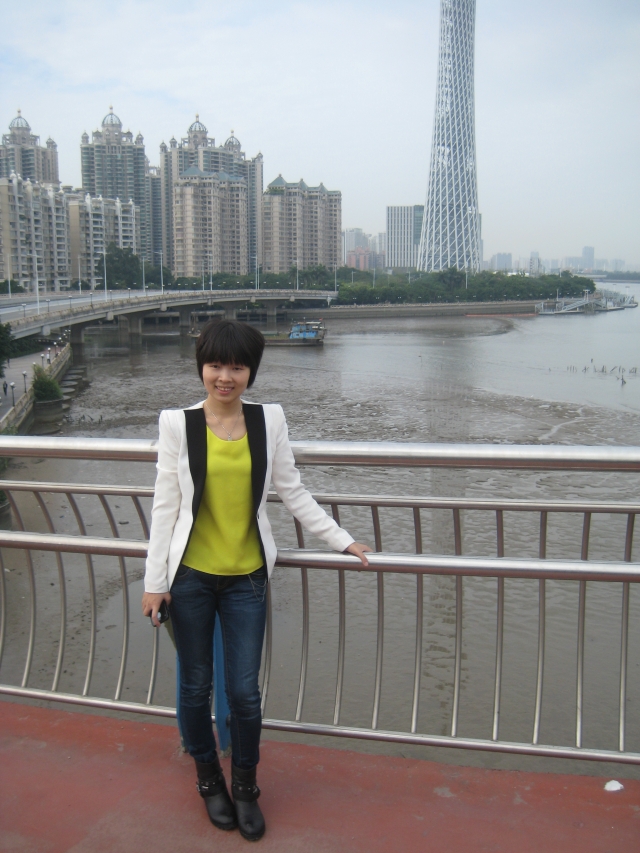
Name: Yang Yang | Gender: Female | Date of Birth: May 10, 1984 | Email: Yang_ouc@163.com | Address: School of Law & Political Science, Ocean University of China, Qingdao, Shandong Province, P.R.China, 266100 | Major: Land Resources Management | Professional Title: Lecturer | Research Interests: Dynamic monitoring of urban land, Protection of cultivated land | Teaching: Basic Theory and Practice of Land Resources Management, Introduction to Management, Strategic Management | Education: (1) Doctor’s degree, College of Resources Science & Technology, Beijing Normal University, Beijing, P.R.China, 2012; (2) Master’s degree, College of Resources Science & Technology, Beijing Normal University, Beijing, P.R.China, 2009; (3) Bachelor's degree, School of Resources and Environmental Sciences, Wuhan University, Wuhan, Hubei Province, P.R.China, 2006. |
|
|
ResearchExperience: [1]Working as the principle investigator of Fundamental Research Funds for the Central Universities “Spatial Pattern Optimization of Land Urbanization of Shandong Province” from Ocean University of China, 01/2014-12/2015 [1]Working as the principle investigator of the Starting Research Fund “Extracting urban expansion information of China in recent 20 years based on DMSP/OLS nighttime light data” from Ocean University of China, 09/2012-09/2013 [2]Participated in the National Basic Research Program of China “International Comparison in large-scale LUCC Process and its driving mechanism (Project No: 2010CB950901)” from the Ministry of Science and Technology (MOST) and focused on the simulation of LUCC process of US and China. 10/2010-07/2012 [3]Participated in the program “Comparative researches of urban expansion between China and America in recent 20, 30 years based on remote sensing and GIS technique (Project No. 2010-KF-02)” from the State Key Laboratory of Earth Surface Processes and Resource Ecology (Beijing Normal University), 10/2010-07/2012 [4]Participated in the Natural Science Foundation of China (NSFC) program “Modeling the Spatial Risk of Urban Expansion in Metropolitan area of Beijing-Tianjin-Tangshan, China (Project No. 40971059)” 01/2010-07/2012 [5]Participated in the program “Rational Using of Unused Land in Northwest Region” from China Land Survey and Plan Institute, 06/2010-12/2010 [6]Participated in the program “Key technical research of environmental impact assessment of land use planning” from China Land Survey and Plan Institute, 08/2008-07/2009 |
|
Paper in SCI/SSCI/EI journals: [1]Yang Yang, Chunyang He, Qiaofeng Zhang, Lijian Han, Shiqiang Du. 2013. Timely and accurate national-scale mapping of urban land in China using Defense Meteorological Satellite Program’s Operational Linescan System nighttime stable light data. Journal of Applied Remote Sensing, 2013,7(073535):1-18. (SCI) [2]Chunyang He, Qun Ma, Tong Li, Yang Yang, Zhifeng Liu. Spatiotemporal dynamics of electric power consumption in mainland China from 1995 to 2008 modeled using DMSP/OLS stable nighttime lights data. Journal of Geographical Sciences, 2012, 22(1): 125-136. (SCI) [3]Zhifeng Liu, Chunyang He, Qiaofeng Zhang, Qingxu Huang, Yang Yang. 2012, Extracting the dynamics of urban expansion in China using DMSP-OLS nighttime light data from 1992 to 2008. Landscape and Urban planning, 106, 62-72. (SSCI/SCI) [4]Yang Yang, Chunyang He, Shiqiang Du. Improving the support vector machine-based method to map urban land of China using DMSP/OLS and SPOT VGT data. International Geoscience and Remote Sensing Symposium, 2011, 2141-2144. (EI) [5]Zhifeng Liu, Chunyang He, Yang Yang. Mapping urban areas by performing systematic correction for DMSP/OLS nighttime lights time series in China from 1992 to 2008. International Geoscience and Remote Sensing Symposium, 2011, 1858-1861. (EI) [6]Yuanyuan Zhao, Chunyang He, Hui Yao, Qingxu Huang, Yang Yang. Effect of drought process on natural production function of cultivated land. Transactions of the CSAE, 2009, 25(12): 278-284. (EI) [7]Chunyang He, Yuanyuan Zhao, Xiaobing Li, Peijun Shi, Yang Yang. Distinguishing the impacts of land use and arid process on natural potential productivity of cultivated land in Agricultural-Pastoral Transection Zone in Northern China. Proceedings of SPIE-The international Society for Optical Engineering, v7144, 2008. (EI) |
|
Respresentative Paper in CSCD: [1]Yang Yang, Chunyang He, Yuanyuan Zhao, Yunwei Qiao. Research on the layered threshold method for extracting urban land using the DMSP/OLS stable nighttime light data. Journal of Image and Graphics, 2011, 16(4): 666-673. [2]Yang Yang, Chunyang He, Xiaobing Li. Evaluation of the suitability of large scale plantations of cultivated Puer tea in Yunnan Province based on GIS. Journal of Beijing Forestry University, 2010, 32(3): 33-40. [3]Han Sun, Chunyang He, Yang Yang. Development of a new primary farmland selection model——a case study of Beijing-Tianjin-Tangshan area. China Land Science, 2011, 25(9): 78-83. [4]Tong Li, Chunyang He, Yang Yang, Zhifeng Liu. Understanding electricity consumption changes in Chinese mainland from 1995 to 2008 by using DMSP/OLS stable nighttime light time series data. Acta Geographica Sinica, 2011, 66(10): 1403-1412. |
|
Non-Peer-ReferredPresentation in International Conference: [1]Yang Yang, Chunyang He. Monitoring urban sprawl in China from 1992 to 2008 using the DMSP/OLS nighttime lights data. Session “SURE – Symposium Urban Ecology for Sustainable Urban Environment”, The 8th International Association of Landscape Ecology (IALE) World Congress, Beijing, China, August 19-22, 2011. [2]Chunyang He, Yang Yang. Comparative researches of urban land expansion processes of the three major urban agglomerations in China by using DMSP/OLS stable night light data. International Conference on Globalization, Innovation, and Urban-Regional Development, Shanghai, China, June 19-20, 2009. |
|
|
|
|
|
|
|